Projects
Dickerson Bay/Bald Point Protection
- State: Florida
- Type: Habitat Protection
- Estuary: Apalachicola Bay
This project would acquire properties containing uplands around Dickerson, Levy, and Ochlockonee Bays in the area known as Bluffs of St. Teresa. The uplands are an intricate mosaic of lakes, depression marshes, mesic flatwoods, scrubby flatwoods, and scrub habitats that are connected to the Gulf by numerous tidal creeks, salt flats, and salt marshes. These habitats adjoin similar communities in St. Marks National Wildlife Refuge to the north and west.
Project Status:
- Conceptual
- Feasibility & Planning
- Engineering & Design
- Under Construction
- Completed
Oyster Bay Wetlands Preservation and Enhancement
- State: Alabama
- Type: Marsh Restoration
- Estuary: Mobile Bay
Oyster Bay and its wetlands serve as an important nursery area for economically important fish and shellfish such as white shrimp, brown shrimp, blue crab, redfish, spotted sea trout, and others. The marsh area also provides habitat for resident and migrating birds and other wildlife. These wetlands consist primarily of black needlerush and salt grass, with some sloughs interspersed throughout the marsh, and pine flatwoods located to the east. This project would protect and provide public access to 350 acres of wetlands and marsh in Oyster Bay.
Project Status:
- Conceptual
- Feasibility & Planning
- Engineering & Design
- Under Construction
- Completed
Mobile Causeway Hydrologic Restoration – Justin’s Bay

- State: Alabama
- Type: Hydrologic Restoration
- Estuary: Mobile Bay
The Mobile Causeway, built in the late 1920s, restricts the natural hydrologic connection between the Mobile-Tensaw Delta and Mobile Bay. The causeway has profoundly altered the hydrology, water quality, salinity, and ecological function of the system—harming finfish, shellfish and other wildlife in the bay and in the delta. The project proposes to elevate the causeway at Justin’s Bay, restoring tidal exchange in the Mobile-Tensaw Delta by re-connecting it to Mobile Bay.
Project Status:
- Conceptual
- Feasibility & Planning
- Engineering & Design
- Under Construction
- Completed
Jourdan River Coastal Preserve
- State: Mississippi
- Type: Habitat Protection
- Estuary: Mississippi Sound
This effort seeks to permanently protect lands adjacent to the Jourdan River Coastal Preserve. The project would add 1,472 acres to the preserve’s existing 573 acres, adding frontage along the Bay of St. Louis and the Jourdan River. This would allow for the improved management of coastal wetlands and adjacent upland areas. The targeted acres lie within the Coastal Preserve boundary in Hancock County. The property consists of open saline marshes containing saltgrass, needle rush, and cordgrass; maritime forests; and tidal brackish marsh. The area is a feeding, resting, and overwintering ground for a variety of migratory birds and would benefit coastal and freshwater aquatic species.
Project Status:
- Conceptual
- Feasibility & Planning
- Engineering & Design
- Under Construction
- Completed
Grand Bay Land Acquisition
- State: Mississippi
- Type: Habitat Protection
- Estuary: Mississippi Sound
The Grand Bay National Wildlife Refuge and Grand Bay National Estuarine Research Reserve collectively protect a diversity of important coastal habitats, including some of the last remaining wet pine savanna in the country. This project will add up to an additional 1,686 acres identified by the U.S. Fish and Wildlife Service and the State of Mississippi as critical for acquisition and long-term management to these protected lands. This acreage contains a diversity of habitats including wet pine savanna, maritime forests, tidal and non-tidal wetlands, salt marshes, salt pannes, bays and bayous.
Project Status:
- Conceptual
- Feasibility & Planning
- Engineering & Design
- Under Construction
- Completed
Galveston Bay Oyster Reef Restoration and Enhancement
- State: Texas
- Type: Living Shoreline/Oyster Restoration
- Estuary: Galveston Bay
In 2008, sediment from Hurricane Ike destroyed up to 60 percent of the oyster reefs in Galveston Bay. In 2017, Hurricane Harvey’s large influx of fresh water caused oyster mortality rates in the bay ranging from 50 to 100 percent. Galveston’s East Bay was particularly badly affected by Hurricane Harvey. This project will result in on-the-ground restoration of up to 400 acres of oyster reef in Galveston Bay. This project would build off of a NRDA study identifying the best locations and sizes for reef restoration as well as a small-scale ‘source and sink’ project funded by NFWF.
Project Status:
- Conceptual
- Feasibility & Planning
- Engineering & Design
- Under Construction
- Completed
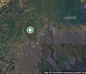
Mad Island Shoreline Protection and Ecosystem Restoration
- State: Texas
- Type: Living Shoreline/Oyster Restoration
- Estuary: Matagorda Bay
The Mad Island Marsh Preserve has experienced high erosion rates of 5 to 10 feet per year since the construction of the Gulf Coast Intracoastal Waterway. The goal of the project is to install 2.3 miles of a nearshore breakwater to reduce persistent erosion at the Mad Island Marsh Preserve. Slowing shoreline loss is critical in maintaining the salinity gradient in this estuarine system and protecting marsh integrity within the Mad Island Wildlife Management Area, in order to benefit nursery habitat for many species. This project supports part of an larger ongoing effort to protect over 6,000 acres of coastal prairie and marsh habitat at Mad Island Marsh Preserve.
Project Status:
- Conceptual
- Feasibility & Planning
- Engineering & Design
- Under Construction
- Completed
Matagorda Bay Tributary Inflow Protection
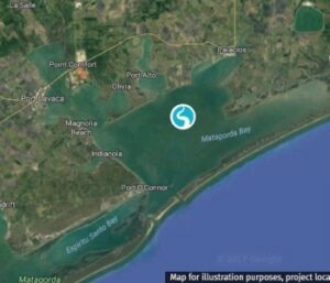
- State: Texas
- Type: Hydrologic Restoration
- Estuary: Matagorda Bay
Freshwater inflows to the Matagorda Bay system are continuing to decline dramatically from historical levels as more and more water is impounded and withdrawn for use upstream of the coast. Purchasing as much as 10,000 acre-feet a year of existing water rights on tributary streams to Tres Palacios Bay would improve conditions for oysters and near-shore aquatic species within the estuarine portion of the Tres Palacios River and would enhance approximately 840 acres of wetland habitat adjacent to that section of the river. The project will also benefit the ecological health of the entire Matagorda Bay estuary system by protecting these types of habitats—and the species that rely on them—during times of drought when other inflows to the system are significantly reduced.
Project Status:
- Conceptual
- Feasibility & Planning
- Engineering & Design
- Under Construction
- Completed
Breton Ridge Restoration: Bayou LaLoutre
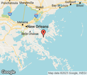
- State: Louisiana
- Type: Ridge Restoration
These two projects would restore historic ridges which provide critical habitat for migratory birds and wildlife in Breton Sound where wetlands are rapidly disappearing. Both projects are located east of the Mississippi River in the Breton-Chandeleur Basin. The Bayou Terre aux Boeufs ridge stretches from the community of Delacroix to Black Bay and the Bayou la Loutre Ridge extends from the community of Yscloskey into the southeastern Biloxi marshes. Restoration of these ridges will raise the ridge height, providing coastal upland habitat, increasing storm surge protection for nearby communities and helping restore the natural flow of water in the basin. Status: Conceptual
Fish and Waterfowl Benefits
Rising sea levels, subsidence and storms have eroded the ridges in Breton Sound. Restoration of these ridges will help maintain the health, stability and function of the existing Breton Sound wetlands. These wetlands provide nursery and foraging habitat to a variety of fish and waterfowl and other wildlife.
Project Status:
- Conceptual
- Feasibility & Planning
- Engineering & Design
- Under Construction
- Completed
Breton Ridge Restoration: Bayou Terre aux Boeufs
- State: Louisiana
- Type: Ridge Restoration
These two projects would restore historic ridges which provide critical habitat for migratory birds and wildlife in Breton Sound where wetlands are rapidly disappearing. Both projects are located east of the Mississippi River in the Breton-Chandeleur Basin. The Bayou Terre aux Boeufs ridge stretches from the community of Delacroix to Black Bay and the Bayou la Loutre Ridge extends from the community of Yscloskey into the southeastern Biloxi marshes. Restoration of these ridges will raise the ridge height, providing coastal upland habitat, increasing storm surge protection for nearby communities and helping restore the natural flow of water in the basin. Status: Conceptual
Fish and Waterfowl Benefits
Rising sea levels, subsidence and storms have eroded the ridges in Breton Sound. Restoration of these ridges will help maintain the health, stability and function of the existing Breton Sound wetlands. These wetlands provide nursery and foraging habitat to a variety of fish and waterfowl and other wildlife.
Project Status:
- Conceptual
- Feasibility & Planning
- Engineering & Design
- Under Construction
- Completed